
Where to Find Miami’s Clearest Beach Today
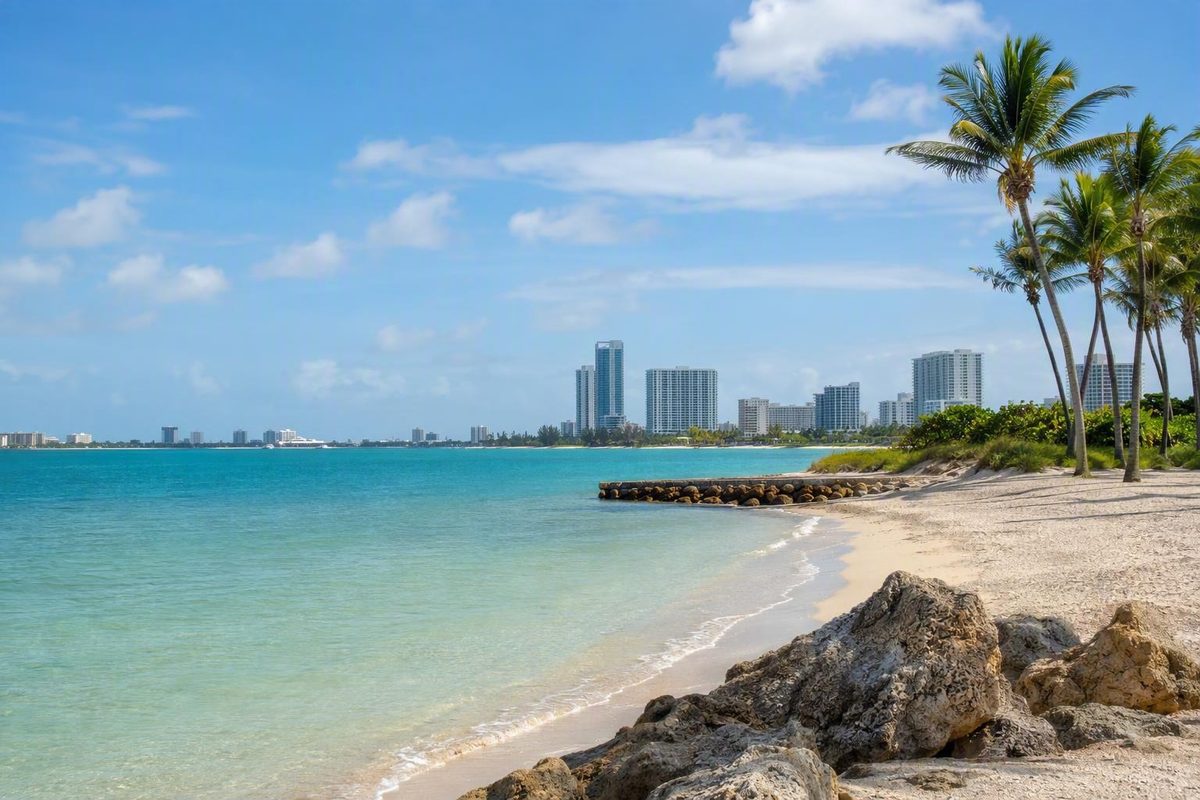
No Miami beach stays seaweed-free. Compare sheltered bayside spots, oceanfront hotspots, live cameras, NOAA risk, and cleanup coverage before you go.
No Miami beach can be guaranteed free of sargassum. During the record 2026 season, the best odds are usually at sheltered or bayside spots such as Hobie Beach and Matheson Hammock, with South Pointe near the jetty as a conditional option. Atlantic-facing Crandon Park, Bill Baggs Cape Florida, Haulover, and Miami Beach—especially 22nd through 32nd Streets—face greater exposure and need a same-day check.
Choose your beach-day goal and today’s wind; the picker ranks 10 places to inspect first.
This ranks where to inspect first. It does not report live seaweed depth or certify swimming safety.
Sheltered locations receive priority. Selecting easterly wind adds caution to Atlantic-facing beaches; missing official cameras add uncertainty. Wind is not fetched automatically.
More Columns
| # | Beach or Section | Shore Type | Recurring Hotspot | Maintenance Evidence | Best Live Check | Decision Note |
|---|---|---|---|---|---|---|
| 1 | Hobie Beach | Bayside / lee side | No | — | NOAA risk plus arrival inspection | Usually a stronger alternative when Atlantic-facing Key Biscayne beaches are affected; never guaranteed clear. |
| 2 | Matheson Hammock | Bayside / sheltered | No | — | NOAA risk plus arrival inspection | Lower open-ocean exposure; no daily official beach-level sargassum figure is available here. |
| 3 | South Pointe near the jetty | Inlet-sheltered section | Adjacent hotspot | Miami Beach seasonal work | 1st Street camera | The jetty may shelter some sections, but north of Government Cut jetty is a recurring buildup area. |
| 4 | South Beach at 1st Street | Atlantic-facing | No | Miami Beach seasonal work | 1st Street camera | A camera-supported choice, but one clear frame does not represent all of South Beach. |
| 5 | Miami Beach at 21st Street | Atlantic-facing | Near 22nd–32nd hotspot | Miami Beach seasonal work | 21st Street camera | Useful direct view near central Miami Beach; compare it with 1st Street at a similar time. |
| 6 | North Beach | Atlantic-facing | No listed four-area hotspot | Miami Beach seasonal work | NOAA risk plus arrival inspection | Outside the 22nd–32nd Street hotspot, but current conditions remain unknown without a local view. |
| 7 | Crandon Park ocean side | Atlantic-facing | No listed four-area hotspot | Included in county maintenance scope | NOAA risk plus arrival inspection | More exposed than Hobie Beach or the marina side; do not rely on an old Key Biscayne report. |
| 8 | Bill Baggs Cape Florida | Atlantic-facing | No listed four-area hotspot | — | NOAA risk plus arrival inspection | Ocean exposure raises arrival risk; no live official beach camera is established in this comparison. |
| 9 | Mid-Beach, 22nd–32nd Streets | Atlantic-facing | Recurring hotspot | Miami Beach seasonal work | 21st Street camera nearby | A county-identified heavy-buildup area; the 21st Street view does not show every block. |
| 10 | Haulover Beach | Atlantic / inlet | Both sides of cut | Within county shoreline scope | NOAA risk plus arrival inspection | Recurring buildup is documented north and south of Haulover Cut; current coverage is not continuous. |
How the inspection order is calculated
The planning rule starts with sheltered, general Atlantic-facing, and recurring-hotspot exposure. E or SE wind adds caution to Atlantic-facing rows; N or NE adds less caution. Swimming and snorkeling add uncertainty where no direct camera exists. Kids’ beach time favors sheltered rows. Clean-sand mode gives documented seasonal maintenance more weight. These are transparent decision rules, not measured sargassum quantities.
Sources: City of Miami Beach management information and conditions and cameras; Miami-Dade hotspots and maintenance scope; NOAA daily inundation risk. No beach is guaranteed clear.
The picker is an inspection order, not a live measurement or swimming-safety rating. A sheltered beach can receive seaweed, while an exposed beach can look comfortable after cleanup or a change in currents, tides, and wind.
The Best Bets Are Sheltered, Not Guaranteed Clear
Hobie Beach and Matheson Hammock generally present the strongest alternatives when Atlantic-facing strands have conspicuous arrivals. Both are on the bay side rather than directly facing the open Atlantic. They still require a visual check because the available official tools do not certify either beach as clear.
South Pointe near the Government Cut jetty is more complicated. The inlet and jetty can shelter some sections, but Miami-Dade also identifies the area north of the Government Cut jetty as a recurring heavy-buildup location. Check the 1st Street camera and inspect the exact access point rather than treating all of South Pointe as protected.
The higher-exposure group includes Crandon Park’s ocean side, Bill Baggs Cape Florida, South Beach, central Miami Beach, North Beach, and Haulover. Miami-Dade’s recurring hotspots include both sides of Haulover Cut and 22nd through 32nd Streets in Miami Beach.
These are exposure patterns, not permanent rankings. A recently maintained oceanfront block may be cleaner than an unchecked bayside alternative at the moment you arrive.
Record 2026 Landings Make Same-Day Checks Essential
August 2026 brought record sargassum landings to Miami-Dade, as reported by The Guardian. Miami Beach reported removing 5,894 cubic yards during the season, compared with a 4,512-cubic-yard five-year baseline on its sargassum management page.
On August 26, Miami Beach still listed Seaweed as an active advisory. The city rated swimming conditions “good” while separately noting seaweed and possible thunderstorms. The distinction matters: a swimming-condition rating does not mean the shoreline is free of seaweed, and a seaweed advisory is not itself a bacterial water-quality advisory.
Check the current Miami Beach conditions report before leaving. The page also leads to the city’s 1st Street and 21st Street camera views.
A citywide advisory confirms that seaweed is an active issue, but it does not quantify every block. Nearby stretches can look different because of fresh arrivals, cleanup timing, shoreline shape, tides, currents, and wind.
Check Cameras, NOAA Risk, and Timestamps Together
Use three kinds of evidence: the official advisory, a current local view, and NOAA’s coastline-level risk estimate. None is sufficient alone.
Compare the 1st Street and 21st Street Cameras
Inspect both Miami Beach camera views, even if only one is near your hotel. Look for:
- a continuous brown line at the water’s edge;
- floating patches immediately offshore;
- large piles on the dry sand;
- enough visible waterline to judge the scene;
- glare, rain, darkness, distance, or obstructions;
- an indication that the image is current.
If 1st Street visibly has less accumulation than 21st Street at approximately the same time, describe it as observed clearer relative to 21st Street. That comparison does not establish that all of South Beach is clear or that every Mid-Beach block has heavy buildup.
Do not infer conditions from the number of people in the water. Beachgoers have different tolerances, and their behavior says nothing reliable about water quality, rip currents, lightning, or conditions outside the camera frame.
Use NOAA as a Coastline Forecast, Not a Beach Camera
NOAA’s Sargassum Inundation Risk tool publishes daily reports at approximately one-kilometer resolution. It combines offshore satellite detection with current modeling and classifies risk as low, warning, medium, or high, according to NOAA’s description of the daily tool.
| NOAA Category | Practical Interpretation |
|---|---|
| Low | Lower modeled inundation risk, not proof of clear sand |
| Warning | A reason to inspect local conditions more closely |
| Medium | Stronger potential for effects; verify with a current view |
| High | Substantial inundation risk; prepare to use an alternative |
The map cannot show whether crews just serviced a block, whether a new patch arrived after the model run, or whether one beach entrance is comfortable. Regional satellite products have the same limitation at a larger scale.
Give the Newest Readable Local Observation More Weight
Record the update or viewing time for each signal. An older forecast should not override a newer, readable camera view, but a camera that is dark, stale, obstructed, or tightly framed deserves little confidence.
| Signal | What It Shows | What It Cannot Establish |
|---|---|---|
| City conditions report | Whether Miami Beach has posted an advisory | Buildup at every block |
| 1st Street camera | Visible conditions within that frame | Conditions across South Beach |
| 21st Street camera | Conditions near that viewpoint | All of central Miami Beach |
| NOAA risk map | Relative coastline-level inundation potential | Whether one patch of sand is clear |
Recheck shortly before departure. Inspect the waterline again before paying for chairs or settling far from your transportation.
Beach-by-Beach Exposure Patterns Narrow the Search
Hobie Beach and Matheson Hammock Usually Offer Lower Exposure
Hobie Beach and Matheson Hammock are the first places to investigate when open-ocean beaches have heavy arrivals. Their bayside or sheltered settings reduce direct Atlantic exposure, but no official source in the available evidence provides a daily sargassum quantity for either location.
Label them unknown until you have a current observation. “Lower exposure” is not equivalent to “no seaweed.”
South Pointe Has Both Shelter and Hotspot Risk
The jetty and inlet can make South Pointe a useful alternative to an open strand farther north. However, the county’s recurring-hotspot list includes the area north of the Government Cut jetty.
Use the 1st Street camera as a nearby signal, then inspect the precise section you intend to use. Do not extend a clear-looking camera frame to the full park or shoreline.
South Beach Has a Useful Camera but Remains Ocean-Facing
The 1st Street camera provides the best official visual check for southern Miami Beach. A clean-looking frame supports a decision about that observed point at that time—not all of South Beach.
Morning maintenance may improve the sand, but another tide can deposit material after crews pass.
Central Miami Beach Includes a Recurring Hotspot
Miami-Dade identifies 22nd through 32nd Streets as a recurring heavy-buildup area. The 21st Street camera is useful nearby, but it cannot display every access point in Mid-Beach.
Treat hotspot status as a risk modifier. If a current view shows comfortable conditions there while another beach visibly has heavy buildup, trust the newer direct observation.
North Beach Is Exposed but Not on the Four-Area Hotspot List
North Beach lies outside the documented 22nd–32nd Street hotspot. That does not prove it escaped the latest arrival. Without a sufficiently current local view or report, its status is unknown.
Haulover Requires Extra Caution
Miami-Dade identifies recurring heavy buildup both north and south of Haulover Cut. Haulover is not continuously covered, but its hotspot status makes an unverified trip less attractive during a major arrival.
Crandon Park and Bill Baggs Face the Atlantic
Crandon Park’s ocean side and Bill Baggs Cape Florida are exposed to Atlantic arrivals. Neither can be called clear based on an old photograph, seasonal description, or report from the previous day.
If Crandon’s oceanfront is affected, inspect Hobie Beach or the Crandon marina side as conditional lee-side alternatives. No current official figure in the available evidence establishes their sargassum levels.
Cleanup Helps the Sand but Cannot Stop New Arrivals
Miami-Dade’s general sargassum season runs from March through October. Miami Beach typically receives its largest amounts in June and July, although the severe August 2026 season demonstrates why the pattern cannot predict a particular day.
County crews conduct daily beach maintenance during the season and generally address buildup early in the morning. Miami Beach says work begins after morning sea-turtle surveys and can continue through the day. Crews may collect, remove, cut, turn, or blend material depending on the location and operating method.
Maintenance is reactive. Regulations prohibit removing sargassum from the water before it lands, and two daily high tides can deliver more material after crews pass.
Official mileage figures refer to different jurisdictions:
- Miami-Dade maintains 17 miles of beach from Government Cut to the Broward County line and at Crandon Park.
- Miami Beach describes work along approximately 7 to 7.5 miles of city shoreline.
Miami-Dade identifies four recurring heavy-buildup areas in its official sargassum guidance: north of Haulover Cut, south of Haulover Cut, 22nd through 32nd Streets, and north of the Government Cut jetty.
A county memorandum covered by CBS Miami said Miami-Dade had permits for six specific areas and was considering a process for adding cleanup locations when needed and feasible without further state review. The report did not name all six, so the remaining locations cannot be inferred.
Seaweed and Swimming Safety Require Separate Checks
Visible sargassum, bacterial water quality, surf, rip currents, lightning, jellyfish, warning flags, and lifeguard instructions are separate considerations.
On August 26, 2026, Miami Beach listed a seaweed advisory while reporting no Florida Department of Health swimming advisories for its ocean beaches. That meant the city was reporting different conditions in separate categories—not that every beach was free of hazards.
Large stranded mats can create odor and health concerns while decomposing. They may release hydrogen sulfide, which can irritate the eyes, nose, and throat or contribute to respiratory problems. Organisms living in the seaweed may irritate skin. NOAA’s scientific Sargassum FAQ explains its ecological role and the effects of large stranded accumulations.
Move away from a decomposing pile if the odor causes eye, throat, or breathing symptoms. Follow posted flags and lifeguard instructions even when the shoreline looks clear.
Keep One Sheltered and One Non-Beach Backup
Choose a primary beach only after checking the advisory, both cameras, and NOAA risk. Keep one realistic alternative nearby rather than repeatedly crossing Miami to test unverified beaches.
If every oceanfront option you can verify has heavy accumulation, switch the type of day. A pool, bayside activity, museum, long lunch, or neighborhood itinerary can preserve the day. An indoor anchor also keeps the beach window movable without committing the itinerary to unstable shoreline conditions.
Before leaving, label each candidate:
- Observed clearer: a current, readable view shows less accumulation than another view checked at roughly the same time.
- Observed buildup: a same-day official report or current view shows meaningful accumulation.
- Unknown: no sufficiently current, location-specific observation is available.
“Unknown” is more accurate than assuming a beach is clear. The best available choice is the lowest-exposure option supported by the newest readable observation—not a beach that someone claims never gets seaweed.