
Plan the Right Oceanfront Walk for Your Miami Beach Day
Conflicting mileage figures generally reflect different endpoints or route formats, not five measurements of one journey. Compare official and shorter routes.
Miami Beach Boardwalk quick facts: name, length, endpoints, and hours
Miami Beach Boardwalk at a glance
- Official name: Miami Beach Beachwalk
- Common names: Miami Beach Boardwalk and South Beach Boardwalk
- City-defined length: Nine miles, one way
- Official endpoints: South Pointe Park to 87th Street
- Surface: Broad, paved promenade
- City-identified uses: Walking, jogging, and conventional cycling
- Accessibility: Described by the City as ADA accessible
- Hours: Open 24 hours daily, although adjoining facilities may keep different hours
These route facts come from the City of Miami Beach’s official Beachwalk listing.
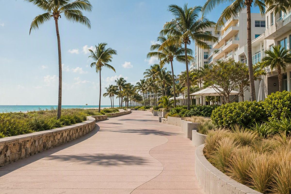
The attraction commonly called the Miami Beach Boardwalk is not simply a short wooden boardwalk in South Beach. The City calls the completed oceanfront facility the Beachwalk and describes it as a wider paver pathway extending from South Pointe Park to 87th Street. The modern route was completed in June 2022.
Visitors, map platforms, tourism publishers, and local businesses still use several names for the same general waterfront corridor. “Miami Beach Boardwalk,” “South Beach Boardwalk,” and “Beachwalk” may all appear in directions, but publishers do not always mean the same endpoints. A guide discussing the “South Beach Boardwalk” may cover only South Beach and part of Mid-Beach, while the City’s definition reaches the northern end of Miami Beach.
There is a historical reason for the naming confusion. The original wooden boardwalk ran approximately from 23rd Street to 45th Street. That former elevated section has been replaced by a broad, on-grade paved path. Destination coverage describes the modern corridor as suitable for walkers, runners, skaters, strollers, conventional bicycles, and wheelchair users, while the City specifically identifies walking, jogging, and cycling as intended uses. Miami’s destination guide explains the former wooden section and the present paved route.
For practical planning, use Beachwalk when referring to the entire City-defined corridor and attach exact endpoints to shorter outings. “Walk the boardwalk” is too vague to tell a driver where to drop you, calculate a realistic turnaround, or establish whether a quoted distance is one way or round trip.
The 24-hour listing also requires context. It means the public path does not have one daily closing time. It does not establish that restrooms, lifeguard stations, rentals, parking facilities, fountains, playgrounds, transit, or other staffed services operate throughout the night.
Why maps call the route four, seven, nine, 10, or 16.4 miles
The conflicting mileage figures generally reflect different endpoints or route formats—not five measurements of an identical journey. A useful map should identify where the route begins, where it ends, and whether the distance is one way or round trip.
| Published distance | What it measures | How to interpret it |
|---|---|---|
| About four miles | Commonly 5th Street to approximately 46th Street | A shorter South Beach-to-Mid-Beach itinerary |
| About seven miles | South Pointe Park to the Surfside border | A route using a shorter northern endpoint than the City’s definition |
| Nine miles | South Pointe Park to 87th Street | The City of Miami Beach’s primary official description |
| About 10 miles | South Pointe Park through connected paths to Bal Harbour | An extended route that crosses beyond Miami Beach |
| 16.4 miles | A mapped out-and-back itinerary | Not the official one-way length |
The approximately four-mile version usually refers to an older visitor-oriented segment from around 5th Street to Indian Beach Park near 46th Street. That is a useful South Beach and Mid-Beach itinerary, but it is not the full completed corridor.
Seven-mile descriptions generally stop around North Beach Oceanside Park or the Surfside border. This creates a coherent outing, but it uses a different endpoint from the City’s stated terminus at 87th Street.
Nine miles is the clearest default when discussing the official Miami Beach route. It is a one-way planning figure. Walking from one official endpoint to the other and then retracing the same route would therefore approach 18 miles before adding pier visits, beach entrances, meal stops, or westward detours.
The approximately 10-mile version continues north on connected waterfront paths toward Bal Harbour. It can be useful to long-distance walkers and riders, but the extension crosses municipal boundaries. It should not be presented as though every segment were part of the City of Miami Beach’s Beachwalk.
The 16.4-mile listing is different again because AllTrails categorizes it as an out-and-back route. It should not be compared directly with one-way point-to-point measurements.
A simple route diagram helps separate the main concepts:
South Pointe Park
        │
   5th Street
        │
 Lummus Park / Ocean Drive area
        │
 Lincoln Road connection ─── westward detour
        │
   23rd Street
        │
 Former wooden-boardwalk area
        │
 Indian Beach Park / about 46th Street
        │
 North Beach Oceanside Park
        │
   87th Street
        │
 Surfside and Bal Harbour connections
 outside the official Miami Beach route
Keep these terms distinct:
- Historic wooden boardwalk: The former structure approximately between 23rd and 45th streets.
- Beachwalk: The modern paved oceanfront corridor defined by the City.
- Miami Beach Boardwalk or South Beach Boardwalk: Informal names that may refer to the full corridor or only its southern portion.
- Ocean Drive promenade: The South Beach waterfront setting associated with Ocean Drive and Lummus Park, not a synonym for the entire Beachwalk.
- Surfside and Bal Harbour connections: Continuing waterfront paths outside the official Miami Beach corridor.
Before saving or sharing an itinerary, label it in a form such as “South Pointe Park to Indian Beach Park, one way” or “87th Street to South Pointe Park, with a transit return.” That one habit resolves most mileage contradictions.
The route from south to north: what each section feels like
The Beachwalk works best as a series of neighborhood sections rather than as an all-or-nothing attraction. Moving south to north, the surroundings shift from waterfront parkland to busy South Beach, then to the hotel-and-dune character of Mid-Beach and the larger recreational areas of North Beach.
South Pointe Park
South Pointe Park is the official southern anchor. Its waterfront paths connect with a pier, playground access, and views toward Government Cut and PortMiami. It is frequently recommended for sunset and ship views, but visibility, marine traffic, weather, and crowd levels vary.
This is a strong choice when the outing matters more than mileage. The park, pier, and nearby beach entrances can occupy more time than a route line suggests. Restaurants and other commercial stops may require leaving the immediate waterfront path.
5th Street through Lummus Park
North of South Pointe, the route enters the classic South Beach setting. The Lummus Park area offers beach entrances, people-watching, volleyball facilities, and convenient access to Ocean Drive.
The Art Deco streetscape is nearby rather than spread continuously along the oceanfront path. Seeing the buildings closely or visiting facilities on Ocean Drive requires a short inland detour.
For many first-time visitors, this is the most direct section for combining beach access, South Beach atmosphere, and architecture. It can also be one of the busier portions of the route.
Lincoln Road connection
Lincoln Road runs east-west and reaches the oceanfront corridor. Treat it as a westward detour rather than part of the north-south Beachwalk.
It can provide a convenient break for food, shopping, or time away from the exposed waterfront. Because the pedestrian district and its businesses extend west, however, a seemingly quick detour can add substantial walking. Decide whether Lincoln Road is a brief meal stop or a separate part of the day.
23rd Street into Mid-Beach
Around 23rd Street, the route enters the area associated with the former wooden boardwalk. The old elevated section between approximately 23rd and 45th streets has been replaced by a broad paved path behind dunes and oceanfront hotels. Farther north, North Beach Oceanside Park occupies the area from approximately 79th to 87th streets. The destination guide provides a south-to-north overview of these route sections.
Mid-Beach is a practical choice for visitors seeking a steadier walk or run with fewer major sightseeing detours than South Beach. “Calmer” remains relative: hotel activity, events, construction, and time of day can alter the experience. The promenade is shared, so walkers and runners should still expect bicycles, skaters, strollers, and other users.
Indian Beach Park around 46th Street
Indian Beach Park is a useful Mid-Beach entrance and a logical turnaround for someone starting in South Beach. It also works as a starting point for visitors who want the paved Mid-Beach experience without beginning at South Pointe.
Several older guides use approximately 46th Street as the northern end of “the boardwalk.” It is better understood as the end of a popular shorter itinerary. The completed Beachwalk continues north.
North Beach Oceanside Park and the northern corridor
Near the northern end, North Beach Oceanside Park offers park paths, picnic facilities, and family-oriented amenities. Some facilities are inside the park or near the Beachwalk rather than directly on the oceanfront promenade.
Families should choose an entrance based on the particular playground, picnic area, restroom, or beach connection they intend to use. General references to amenities do not prove that every feature is available at every entrance.
Connected waterfront paths continue through Surfside and toward Bal Harbour. Those links make a longer journey possible, but crossing a municipal boundary can affect route names, signs, maintenance, and local rules.
Choose a short walk, half-day outing, or full-route trip
The most useful itinerary depends less on your maximum walking distance than on what you want to stop and see. Beach time, architecture, playground visits, meals, and weather breaks can matter more than pace.
Short scenic plan: South Pointe Park to Lummus Park
Begin at South Pointe Park and follow the waterfront north toward 5th Street and Lummus Park. Allow time for the pier, Government Cut views, beach entrances, and the transition into the Ocean Drive area.
This plan suits first-time visitors who want variety without committing to a long route. It also offers several places to turn back or leave the waterfront if heat, rain, or crowds become uncomfortable.
Art Deco and people-watching plan
Start near 5th Street and follow the Lummus Park waterfront north. Move inland toward Ocean Drive when you want a closer look at the architecture, then return to the Beachwalk or continue toward the Lincoln Road connection.
If time is limited, choose either a longer oceanfront walk or a fuller Lincoln Road visit. Trying to explore both comprehensively can create unnecessary backtracking.
Calmer Mid-Beach plan
Enter around 23rd Street or use Indian Beach Park near 46th Street as a starting point or turnaround. This plan emphasizes the paved route behind dunes and hotels, with fewer reasons to leave the path for major sightseeing.
A simple out-and-back from one known entrance is often easier than improvising a distant exit, especially when someone in the group needs a particular restroom, parking facility, or accessible return point.
North Beach family plan
Center the outing on North Beach Oceanside Park and the surrounding northern corridor. Build the day around a manageable path segment, picnic time, park paths, and any recreational facilities you have confirmed in advance.
For families with young children, a shorter loop near one selected entrance will generally be easier than a long point-to-point walk.
Full route: South Pointe Park to 87th Street
Treat the complete route as a sustained urban walk, run, or conventional bicycle ride—not as a casual stroll that automatically includes the return. Carry water, use sun protection, establish return transportation, and keep enough flexibility to stop early.
One commercial visitor guide estimates approximately 90 minutes for the shorter South Pointe-to-46th-Street walk without stops. That is only a rough benchmark; pace, heat, photographs, beach visits, pier time, crossings, and inland detours can change the duration substantially. See the guide’s four-mile walking estimate.
For a one-way outing, possible return modes include the Miami Beach trolley, Metrobus, rideshare, taxi, or a conventional bike-share bicycle where permitted. Check current routes, schedules, station inventory, and service notices before setting out. A return option shown on a static map may not be available when you finish.
Getting there without a car—and what to know about parking
The Beachwalk fits naturally into a neighborhood-based, car-light Miami Beach day. If you are staying nearby, walking to the closest entrance may be simpler than traveling to a famous southern map pin.
Supported access options include:
- Walking from a Miami Beach base
- Free Miami Beach trolley service
- Metrobus
- Rideshare or taxi
- Conventional Citi Bike
- Street parking
- Municipal garages
- Surface parking
Choose your entrance before choosing transportation. A visitor walking from South Pointe to Mid-Beach needs a different drop-off and return plan from a family spending two hours near North Beach Oceanside Park. Because the route is linear, an easy arrival does not guarantee an easy return.
Apple Maps lists 500 Ocean Drive as a Miami Beach Boardwalk location. View the 500 Ocean Drive listing on Apple Maps.
For Mid-Beach, Indian Beach Park, 4601 Collins Avenue, is a commonly suggested access point. An unofficial map updated in 2022 also reports public garages near 7th Street and Collins Avenue and 13th Street and Collins Avenue, along with trolley access near Collins Avenue, Washington Avenue, and Alton Road. Those details are useful as orientation, not as a current guarantee; stops, availability, service intervals, and parking conditions can change. Review the dated access and parking map.
Drivers should make parking part of the endpoint decision. A South Beach garage may work well for a South Pointe-to-Lummus outing but poorly for a walk ending in North Beach. For a point-to-point trip, compare the effort of returning to the car with the option of parking near the intended finish and taking transit or rideshare to the start.
Do not build a schedule around an unverified parking price or assume that a garage will have space. Beach demand, events, construction, and local restrictions can affect access. Read posted signs and leave enough time to change entrances.
If the Beachwalk is only one part of a larger city itinerary, Miami Finder’s guide to exploring Miami without renting a car explains how to organize a day by neighborhood. It is broader trip-planning guidance, not evidence for Beachwalk route details.
Accessibility, restrooms, water, playgrounds, and beach access
The City describes the completed Beachwalk as an ADA-accessible paver pathway. Its broad, paved design represents a substantial change from the former elevated wooden section. The City also reports restrooms, water fountains, playgrounds, and other amenities at various beach entrances and adjacent parks.
That route-wide description does not guarantee identical access at every adjoining facility. An accessible promenade does not establish that every street entrance, restroom, parking space, beach ramp, or route onto the sand has the same features.
Wheelchair users, people using other mobility devices, and families with strollers should confirm:
- The exact entrance they intend to use
- The street-to-Beachwalk connection
- Accessible parking or transit access, if required
- Restroom location and operating status
- The condition of the intended beach-access route
- Construction, barriers, or event detours
- The planned exit and return transportation
Path accessibility and sand access are separate questions. A paved, on-grade promenade does not prove that a particular beach entrance offers the required surface or equipment. Do not assume that beach mats, beach wheelchairs, or accessible parking spaces are available at a specific entrance without current confirmation.
Carry water even though fountains are reported along the corridor. Their exact spacing and operating status are not established consistently enough to make them the only hydration plan, especially for a long one-way outing or a visit during hot conditions.
Playgrounds and park facilities can make South Pointe and North Beach attractive to families, but “near the Beachwalk” may mean a short connection through an adjoining park. Identify the specific facility before arrival rather than expecting every amenity to sit directly beside the promenade.
Bicycles, e-bikes, skates, and shared-path etiquette
The City identifies conventional cycling as an intended Beachwalk use alongside walking and jogging. The broad path makes a car-light ride possible, but it remains a shared promenade rather than an uninterrupted bicycle-only corridor.
Bicycle type matters. A destination transportation guide dated December 2, 2025, states that electric bicycles are prohibited on Miami Beach sidewalks, including the Beachwalk and Lincoln Road. The same guide identifies bicycle restrictions in parks including Lummus Park and South Pointe Park. These statements should be treated as dated destination guidance, not as a substitute for checking current municipal rules and posted signs. Read the attributed bicycle and e-bike guidance.
Do not assume that a general statement allowing conventional cycling overrides a restriction posted in an individual park. If signs direct riders to dismount, leave the path, or use an adjacent route, follow them.
The available guidance does not establish that e-scooters, hoverboards, and every other powered device follow the same rule as e-bikes. Check the current rule for the specific device rather than extending the e-bike statement by analogy.
Destination coverage also describes skaters and rollerbladers as Beachwalk users. Posted restrictions in parks or crowded areas still control, and skaters need enough room to slow or stop without sweeping across the path.
Basic shared-path etiquette improves the experience for everyone:
- Keep right where appropriate and consistent with posted signs.
- Pass only when there is enough room.
- Give a clear, calm warning before passing.
- Slow near children, strollers, entrances, and congested areas.
- Move aside before stopping for photographs or directions.
- Avoid riding abreast when doing so blocks other users.
- Supervise children closely around faster traffic.
- Expect people to enter from beach paths, hotels, parks, and side connections.
Pedestrians should check behind them before changing direction or stepping across the path. That need for awareness does not make the Beachwalk inherently unsafe; it reflects the normal tradeoffs of a busy shared corridor.
Best time to go: heat, rain, crowds, and after-dark limits
Early morning is often the most practical time for a long walk, run, or ride because it may reduce exposure to midday heat and activity. No hour is guaranteed to be cool or uncrowded. The east-facing shoreline also makes sunrise a natural attraction.
South Pointe Park is frequently recommended for sunset and views toward Government Cut and PortMiami. Clouds, haze, seasons, events, and marine traffic affect what visitors actually see, so do not plan around a guaranteed ship sighting or clear sunset.
Bring sun protection and choose a conservative route length. Shade is not continuous, and an outing that feels easy in mild morning conditions can become much harder as the day warms. AllTrails specifically cautions that its mapped paved route can become hot and busy in the middle of the day. Review the route’s heat and midday-crowd caution.
Hydration is particularly important on a long outing or when supervising children. Reported fountains are useful backups but should not replace carrying water for the first part of the trip. If someone begins struggling with the conditions, shorten the route rather than pushing toward an arbitrary endpoint.
Monitor the forecast for thunderstorms and unstable weather. A flexible plan might reverse the order of the walk and meal, shorten the outdoor section, or use the nearest practical exit. Miami Finder’s rainy-day discovery plan offers general ideas for reorganizing a Miami day, but it does not provide live Beachwalk conditions.
Twenty-four-hour path access does not prove uniform lighting, activity, staffing, lifeguard coverage, restroom availability, transportation, or personal safety throughout the night. Conditions can differ by section and hour.
Before departure, check:
- Current weather and thunderstorm risk
- City or park notices
- Construction and temporary barriers
- Posted route detours
- Transit and trolley service
- Parking availability and restrictions
- The status of any essential accessible entrance or facility
Build the Beachwalk into a practical Miami Beach day
The easiest way to include the Beachwalk in a Miami itinerary is to choose one geographic cluster and stay with it. Pairing one route section with nearby stops saves time and reduces the chance that heat, traffic, or transit delays will consume the day.
South Pointe and Lummus Park cluster
Combine South Pointe Park, the pier, a manageable stretch of Beachwalk, beach time, and the Ocean Drive or Art Deco area. The park and waterfront connect directly with the route; closer exploration of Ocean Drive and the historic streets requires moving inland.
A practical order is South Pointe early, Lummus Park later in the morning, and lunch or architecture time away from the exposed waterfront. Reverse the order if weather or transportation makes that easier.
Lincoln Road cluster
Use the Beachwalk as the north-south element and Lincoln Road as the east-west detour. This pairing works when you want an oceanfront walk followed by food, shopping, or an indoor break.
Be realistic about distance. Lincoln Road extends west from the waterfront, so a “quick detour” can become a separate walk. Confirm the location and opening hours of any particular business before leaving the Beachwalk.
Mid-Beach cluster
Keep a Mid-Beach day focused on the quieter waterfront stretch, nearby hotel areas, and dining that is genuinely close to your entrance. Adding distant South Beach or mainland attractions can defeat the purpose of choosing Mid-Beach.
An out-and-back from Indian Beach Park or another confirmed entrance is easy to shorten and reduces the need to arrange transportation from an unfamiliar finish point.
North Beach cluster
Center the outing on North Beach Oceanside Park, a northern Beachwalk section, and nearby neighborhood amenities. This can be a practical structure for families or visitors who prefer park time to Ocean Drive sightseeing.
Confirm which picnic area, playground, restroom, or recreational feature you intend to use. Some amenities may be inside an adjoining park rather than directly on the promenade.
Keep public-route information separate from commercial decisions. A restaurant, hotel, rental shop, or tour may be convenient, but proximity and operating hours require their own verification. Inclusion in a tourism guide does not make a business part of the public Beachwalk.
Use this pre-departure checklist:
- Endpoints: Where exactly will you start and finish?
- Direction: Is the route one way or round trip?
- Return: Will you walk back, use transit, call a rideshare, or collect a parked car?
- Rules: Have you checked current bicycle or device restrictions?
- Water: Are you carrying enough rather than relying entirely on fountains?
- Sun: Do you have suitable protection for an exposed waterfront route?
- Weather: Could heat, rain, or thunderstorms change the plan?
- Access: Have you confirmed any essential entrance, restroom, or mobility feature?
- Conditions: Are there current closures, construction areas, or posted detours?
- Detours: How much time will food, architecture, shopping, or beach stops add?
Frequently asked questions
Is the Miami Beach Boardwalk seven miles or nine miles long?
Both figures can describe coherent routes, but they use different northern endpoints. Third-party seven-mile descriptions commonly stop at the Surfside border or around North Beach Oceanside Park, while the City-defined route continues to 87th Street. Compare the seven-mile South Pointe-to-Surfside description.
For planning, treat the City-defined route as the primary reference and label any shorter itinerary with its exact endpoints and direction of travel.
Is the Miami Beach Boardwalk open 24 hours?
The City lists the Beachwalk as open continuously. Tripadvisor likewise displays daily hours of 12:00 a.m. to 11:59 p.m., although that listing does not establish overnight service at adjoining facilities. See the platform’s displayed access hours.
Restrooms, lifeguard stations, fountains, rentals, parking facilities, playgrounds, and transit can have separate hours or availability. Nighttime lighting, staffing, and activity may also vary by section.
Can you ride a bicycle or e-bike on the Beachwalk?
The City identifies conventional cycling as an intended Beachwalk use, subject to posted restrictions in individual areas. Riders should slow in congestion, follow signs, and dismount or use an adjacent route where directed.
A December 2025 destination guide states that e-bikes are prohibited on Miami Beach sidewalks, including the Beachwalk and Lincoln Road, and identifies bicycle restrictions in parks such as Lummus Park and South Pointe Park. Because this is dated destination guidance rather than the text of a current ordinance, confirm municipal rules before riding. Check the cited bicycle guidance and its verification directions.
Is the Miami Beach Beachwalk wheelchair and stroller accessible?
The City describes the completed route as an ADA-accessible paver pathway, and destination coverage presents the broad, on-grade promenade as suitable for wheelchair and stroller use. A commercial route guide also describes the paved South Beach-to-Mid-Beach section as accessible. Review the route guide’s accessibility description.
That route-wide description does not guarantee identical access at every entrance or onto the sand. Confirm the intended street connection, restroom, accessible parking or transit option, beach-access feature, and any temporary obstruction before visiting.
What is the best section for a short first visit?
For many first-time visitors, South Pointe Park to the Lummus Park and Ocean Drive area offers the most variety. It combines waterfront park paths, a pier, beach access, people-watching, and nearby Art Deco streets without requiring a full-route outing.
For a steadier waterfront walk with fewer South Beach sights, choose Mid-Beach north of 23rd Street and use Indian Beach Park as an access point or turnaround.
The Miami Beach Boardwalk is most useful when it is not treated as one all-or-nothing attraction. Begin with the City’s South Pointe Park-to-87th Street definition, then select the neighborhood section that fits your day. Fix your endpoints and return plan in advance, check current weather and posted rules, and leave room for heat, rain, photographs, beach time, and off-route stops.