
Which Places Actually Count as Suburban Miami?
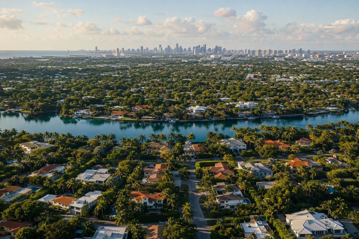
See why the label is informal, how municipalities differ from neighborhoods, and which eight incorporated communities are useful starting points.
There is no official Miami-Dade County category called a “suburb.” A practical Miami-suburbs search should distinguish incorporated cities, towns, and villages from City of Miami neighborhoods and other communities, then compare places against the visitor’s itinerary or the relocation researcher’s needs. Aventura, Coral Gables, Cutler Bay, Doral, Miami Lakes, Palmetto Bay, Pinecrest, and South Miami are useful—but not exhaustive—municipal starting points.
The short answer: “Miami suburb” is an informal label
Miami-Dade County contains 34 incorporated municipalities, as well as unincorporated communities and neighborhoods. The county identifies municipalities and their incorporation dates but does not classify any place as a suburb. “Miami suburb” is therefore an informal geographic or functional label, not an administrative designation. See Miami-Dade County’s municipality list.
For this guide, the term means an independent or otherwise distinct Miami-area community commonly discussed in relation to the City of Miami. That working definition is useful for building a shortlist, but Greater Miami does not fit neatly into a central-city-and-bedroom-suburbs model.
Municipal status describes how a place is classified administratively, not how suburban it looks or feels. An incorporated municipality may contain dense commercial districts, lower-density residential areas, major attractions, or an identity distinct from Miami. An unincorporated community can also have suburban characteristics without being a separate municipality.
This guide is consequently an orientation tool, not an official roster or ranking. It does not determine which community is safest, most affordable, easiest to reach, or most suitable for a particular household.
City, suburb, municipality, or neighborhood: how the labels differ
The City of Miami is one municipality within the much larger Miami-Dade County. The city, county, and wider metropolitan area are not interchangeable terms.
An incorporated municipality is a city, town, or village included on the county’s official municipality list. Unincorporated communities and neighborhoods are acknowledged as different place types, although the county’s municipality reference does not provide a comprehensive list or define their local boundaries.
A neighborhood is a named area within a larger jurisdiction. Coconut Grove, for example, may interest someone looking for a quieter Miami base, but it is a City of Miami neighborhood rather than an independent municipality.
Tourism directories organize places differently from government references. Greater Miami’s destination directory combines municipalities, neighborhoods, beaches, geographic areas, and transportation points because it is designed for trip discovery rather than administrative classification. The directory’s treatment of Coconut Grove as a Miami neighborhood illustrates why appearing in a tourism guide does not make a place a suburb.
Before comparing two locations, identify whether each is:
- an incorporated municipality;
- an unincorporated community;
- a City of Miami neighborhood;
- a neighborhood within another municipality; or
- a broad tourism or geographic area.
That distinction prevents comparisons between places whose names refer to fundamentally different kinds of geography.
Eight incorporated communities commonly considered in a Miami-suburbs search
The eight places below appear on Miami-Dade County’s official list as incorporated municipalities. Their inclusion supports classification and preliminary trip research; it is not a residential endorsement or a claim that they are Miami’s only possible suburbs. Consult the county reference for their municipal status.
Visitor details are limited to information presented by the Greater Miami tourism directory. A dash means that this guide is not assigning an orientation or visitor profile, not that the community lacks attractions or amenities.
| Place | Official status | Supported orientation | Visitor context |
|---|---|---|---|
| Aventura | Incorporated municipality | — | Shopping, dining, and access to Oleta State Park |
| Coral Gables | Incorporated municipality | — | Miracle Mile, Venetian Pool, and the Biltmore Hotel |
| Cutler Bay | Incorporated municipality | South Dade | Described alongside neighboring Palmetto Bay |
| Doral | Incorporated municipality | — | — |
| Miami Lakes | Incorporated municipality | — | — |
| Palmetto Bay | Incorporated municipality | South Dade | Described alongside neighboring Cutler Bay |
| Pinecrest | Incorporated municipality | — | — |
| South Miami | Incorporated municipality | — | — |
The visitor information should be read narrowly. Aventura’s documented shopping, dining, and park access may fit a particular itinerary, but those features do not establish its quality of life or overall suitability. Coral Gables’ named landmarks likewise provide reasons to investigate it as a visitor base without proving that it is the best place for a hotel or home.
Cutler Bay and Palmetto Bay belong in the same preliminary search when a trip is concentrated in South Dade. Their proximity does not make them interchangeable: the practical comparison still depends on the exact lodging address, daily destinations, transportation options, and travel schedule.
Names that need extra classification care
Kendall appears in Greater Miami destination coverage, but a tourism listing alone does not establish the governmental status or precise boundary relevant to a particular address. It can be treated as a distinct search area, but it should not be compared with municipalities until the applicable jurisdiction and location are clear.
Coconut Grove requires a different distinction. Miami Finder groups Coral Gables and Coconut Grove as options for visitors seeking a quieter, slower-feeling cluster. That is visitor-planning guidance, not a claim that Coconut Grove is an independent suburb.
Miami Beach, Hialeah, and Homestead are included on Miami-Dade County’s list of incorporated municipalities. Their administrative status does not settle whether “suburb” is the most useful functional description. Depending on the criteria being applied, a municipality might instead be understood as a distinct urban center, satellite city, or destination in its own right.
There is no need to force every Miami-area place into a suburb-or-not binary. A defensible classification method would need published criteria addressing matters such as:
- position relative to the City of Miami;
- development density and land-use pattern;
- connection to the Miami urban core;
- the presence of an independent civic or commercial center; and
- commuting relationships with major employment areas.
Without such a method, definitive labels would imply more certainty than the informal term supports.
How to choose a Miami-area base without relying on a generic ranking
Start with the trip rather than a list of supposedly best suburbs.
- Identify the anchors. Mark the people, attractions, appointments, beaches, business districts, or departure points that must be reached.
- Choose the leading priority. Decide whether beach access, shopping, specific landmarks, airport access, or a quieter setting matters most.
- Group nearby outings. Build each day around a limited part of the map instead of repeatedly moving across the metropolitan area.
- Test exact transportation. Check the actual route and schedule for the expected date, departure time, and return time.
- Keep alternatives nearby. Choose flexible or indoor options close to the base so a change of plans does not require another long journey.
Miami Finder’s guide to exploring Miami without renting a car recommends choosing a base first, organizing outings geographically, and combining walking, transit, buses, trolleys, or short rideshare connections where practical. Treat that as a planning framework, not evidence that any featured municipality is car-free or broadly transit-friendly.
For a first-pass comparison:
- Consider Coral Gables when Miracle Mile, Venetian Pool, or the Biltmore Hotel is central to the itinerary.
- Consider Aventura when its documented shopping, dining, or Oleta State Park access fits the planned activities.
- Research Cutler Bay and Palmetto Bay together when most destinations are in South Dade.
- Compare any outlying option with a central Miami base when the itinerary is spread across the urban core, beaches, and other parts of the county.
Use exact routes rather than straight-line distance or general claims that somewhere is “close to Miami.” Test both outbound and return journeys because the practical result may differ by direction and time.
For bad-weather planning, Miami Finder recommends structuring the day around indoor anchors, short local moves, and flexible outdoor windows. Its rainy-day planning approach supports keeping backup activities near the chosen base rather than building the day around another cross-county trip.
What relocation researchers still need to verify
Municipal status and visitor attractions are not enough to choose where to live. They can clarify jurisdiction and help organize an initial visit, but they do not answer questions about cost, education, safety, transportation, property risk, or neighborhood fit.
Use a dated, address-specific worksheet:
| Field | What to collect | How to compare |
|---|---|---|
| Housing costs | Sale prices, rents, fees, and maintenance | Match property type, size, and date |
| Taxes and insurance | Address-specific estimates and coverage terms | Compare total recurring costs |
| Commute | Trips to each workplace or regular destination | Record mode, day, departure, and return |
| Transit | Stops, transfers, schedules, and service span | Check the exact address and timetable |
| School assignment | Attendance boundary and program rules | Verify the individual address |
| Crime data | Consistently defined incidents and time period | Use equivalent geographic units |
| Walkability | Routes to groceries, services, and recreation | Test the address, not the city name |
| Flood exposure | Property-level flood information | Check the parcel or address |
| Evacuation zone | Current zone and evacuation route | Verify separately from flood exposure |
| Hurricane risk | Building features, preparation, and coverage | Review property-specific conditions |
Commute research should name the destination, mode, day, departure time, and return time. “Close to Miami” is not sufficiently precise when one person travels to Brickell, another to the airport area, and another within South Dade.
Coastal or recreational appeal should also be considered alongside property-level flood exposure, evacuation planning, hurricane risk, and insurance availability and cost. Avoid labels such as “best for families,” “ideal for retirees,” or “best value” until current, authoritative evidence supports them.
A useful Miami-suburbs search begins with accurate place labels and real destination needs—not a universal ranking. Visitors can use the eight municipalities above as starting points and compare exact itineraries from each potential base. Relocation researchers should continue with current, authoritative information about housing, schools, safety, transportation, flood exposure, evacuation planning, and insurance before choosing a community.